
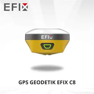
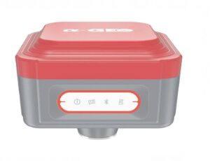
GPS EFIX C8
EFFORTLESS AR VISION NAVIGATION + VISION STAKEOUT
• Convenient AR Vision Navigation: Long-distance guidance with large arrows and accurate real-time distance indication
• Real-Time AR Vision Stakeout: Integration of GNSS, IMU, and advanced vision fusion technology with dual cameras.
• Real-Time Stakeout Point Display: Represent with red dots in the eField software to achieve precise stakeouts by poking the pole, doubling efficiency.
• EFIX Virtual Pole Tip Technology: Maintain visibility of virtual pole tip for a clear and unobstructed display.
VISION SURVEY: ACCURATELY MEASURE COMPLEX SCENES IN REAL-TIME
• Easily measure complex scenes with integrated GNSS, IMU and vision fusion algorithm.
• Acquire highly accurate 3D coordinates from real-time video, including signal-obscured, hard-to-reach, and hazardous points.
• Dynamic panoramic shooting with automated image matching for fast and accurate vision surveying.
• Seamlessly collect and use data once, without interruption or rework, ensuring excellent data usability.
EFFICIENT 3D MODELING FOR FIELD AND OFFICE WORK
• Collaborative modeling with drones: Utilize real-time RTK measurements and dynamic shooting to enhance modeling capabilities, replacing traditional photo-based methods.
• Streamlined single building modeling: Seamlessly capture and model individual buildings using vision RTK panoramic dynamic shooting, eliminating the need for equipment changes.
• Manual precision modeling support: Export engineering data to industry-standard software, such as ContextCapture, to create highly accurate 3D models for real-world projects.
FULLY INTEGRATED GNSS AND 4D AUTO-IMU
• Automatic on-the-move IMU initialization eliminates threshold requirements.
• Maintain accuracy within 3cm even when the range pole is not held perfectly upright.
• 0~60° pole tilt capability allows reaching areas where centering is difficult or dangerous, or simply sparing users from the task.
• Enhances measurement and stakeout efficiency by 30%.
FULL CONSTELLATION SUPPORT AND ADVANCED RTK ENGINE: RTK SIGNAL BOOSTED BY 60%!
• GPS, GLONASS, Galileo, BeiDou and QZSS, 1608 signal channels for tracking them all.
• High efficiency SoC provides 60% increase in computing speed.
• Advanced Full-Star technology and RTK algorithm ensure millimeter to centimeter accuracy.
• Adaptive anti-interference and multipath mitigation capabilities ensure reliable and stable precision.
Reviews
There are no reviews yet.